Viasat Demonstrates New UK SBAS Navigation System
25th Jan 2024
Viasat has successfully completed the first demonstration of their UK Satellite Based Augmentation System (UK SBAS). Once operational, the system will provide greater navigational accuracy for air, maritime, and land transportation. The UK satellite communications company built UK SBAS with the aid of many UK-based space companies. Funding was also acquired from the European Space Agency through the UK’s Department of Transportation.
Anthony Browne, Technology Minister at the Department for Transport, said in a statement: “this successful demonstration illustrates the UK’s first-class space sector, and our capabilities in position, navigation and timing specifically. The project… is directly supporting our work on future provision of high-accuracy, high-integrity positioning services, which could increase efficiency and enable new innovations across the transport network.”
UK SBAS Demonstration
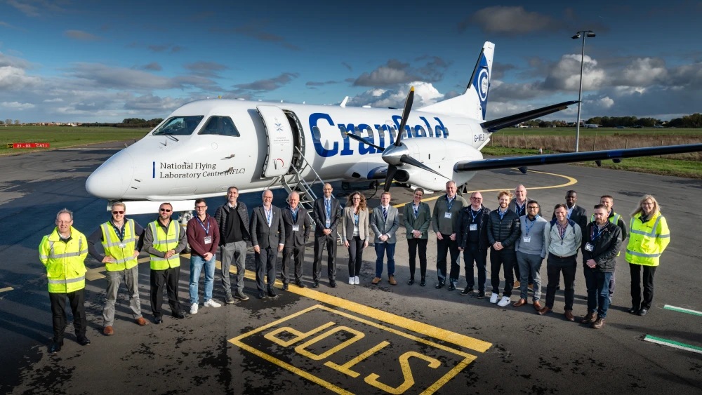
In January, Viasat took UK SBAS to the sky’s to demonstrate the system’s satellite navigational effectiveness. The test was successfully completed after it left the runway at Cranfield Airport onboard a SAAB 340B aircraft. Viasat said the test was ultimately conducted in order to showcase the system’s ability to deliver “more precise… navigation data.”
The project saw many space organisations come together to build the system. Notably, Goonhilly Earth Station, CGI UK, GMV, Ordnance Survey, Cranfield University, the Cranfield National Flying Laboratory Centre, and Pildo Labs.
Under Viasat’s leadership, they collaboratively linked ground stations with satellite connectivity to attain “more reliable navigational data,” Viasat said. With this data, Viasat affirmed they: “can offer positioning down to a few centimetres of accuracy, rather than the few metres provided by standard GPS.”
Brexit & The Need For Greater Navigation Services
Following the UK’s exit from the European Union, Britain has been without a geostationary navigation service. Primarily, this was due to the UK cutting ties with many EU-based resources such as the European Geostationary Navigation Overlay Service (EGNOS).
Viasat said: “While EGNOS can still be used for non-safety applications in the UK, the trial aims to provide a first step toward a complementary UK SBAS which can be used for critical safety of life navigation services across air, land, and sea.”
Interestingly, the project’s funding came from the European Space Agency’s NAVISP programme, via the Department for Transportation. Regardless of Brexit, the UK remains a member nation of ESA, and is receiving considerable backing from ESA for their own home-grown navigation overlay. Viasat is also working with ESA to develop their InRange spacecraft telemetry relay device.
How Brexit Affected The Aviation Sector’s Navigational Capabilities
One of the main areas of Britain’s transportation sector affected by the conclusion of EGNOS is the aviation industry. Fundamentally, pilots face great obstacles when landing – especially when their view of the runway is obstructed by the weather.
Significantly, over 72 airports lost access to EGNOS after Brexit. Of these, 19 airports were heavily reliant on the system prior to Brexit. Research conducted by Viasat found that 40% of flight cancellations due to adverse weather could have still flown with the use of UK SBAS, according to the consulted flight operator.
As such, Viasat said: “[UK SBAS] means improved safety and fewer missed landings because pilots… can get significantly closer to the ground during an approach before making the decision whether to land.”
Tests To Come For UK SBAS
With UK SBAS’ first demonstration complete, Viasat are now setting their sights on future tests on other modes of transportation. The company said: “the trial is aimed to test the system in other transport applications… rail, uncrewed aerial vehicles, or autonomous road vehicles.” Dates are yet to be set for further SBAS test runs.
Visat’s President of International Government, Todd McDonnell, said “This trial on a sovereign UK SBAS is all about delivering trust. Trust for pilots in their tracking systems so they can stay safe in challenging conditions. Trust for the aviation industry more broadly so it can rely on data to operate more efficiently. And in the future, trust that we can use highly accurate tracking to develop Britain’s transport system as new technologies come into play. We’re excited to continue the trial and see how far we can take it.”


Thank you for your comment! It will be visible on the site after moderation.