How Will Scientists Predict Natural Disasters With Digital Earth Replica?
10th Mar 2024
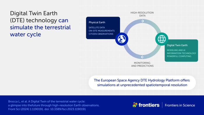
In a bid to assess and predict adverse weather phenomena, scientists have built a ‘digital twin’ of Earth’s water cycle. As time goes on, the Earth is rapidly succumbing to climate change. The impact of humans has resulted in weather becoming highly unpredictable, and more formidable.
In order to forecast when these weather events will occur, scientists will use the digital replica and run simulations, often to the brink of destruction – but luckily, without causing any damage in reality. Ultimately, they aim to achieve: “an interactive tool anyone can use to map risks like floods and landslides and manage water resources.” As a result, decision makers will be able to better understand natural disasters and know when they will strike next.
“Simulating the Earth at high resolution is very complex, and so basically the idea is to first focus on a specific target. That’s the idea behind what we have developed — digital twin case studies for the terrestrial water cycle in the Mediterranean Basin. Our goal is to create a system that allows non-experts, including decision-makers and citizens, to run interactive simulations,” said Dr Luca Brocca of the National Research Council of Italy and lead author of the study.
Creating A Digital Version of Earth’s Water Cycle
Via funding from the European Space Agency (ESA), scientists have constructed an exact digital duplicate of Earth’s “terrestrial water cycle”. It includes “snowcaps on mountains to soil moisture in valleys,” the study read. To build the replica, the team of scientists accessed a vast amount of data obtained by satellites. They also used “Earth observation data that measures soil moisture, precipitation, evaporation, river discharge, and snow depth.”

From there, the virtual model will be constantly updated with the latest data sets in order to run simulations. Most importantly, it will enable greater foresight when preparing for dangerous weather conditions before they happen. Additionally, the model will also be able to assist in forecasting the best and worst case scenarios.
Brocca said: “such information is vital for sustainable development and protecting vulnerable populations.” Adding: “this project is a perfect example of the synergy between cutting-edge satellite missions and the scientific community. Collaborations like this… will be crucial for managing the effects of climate change.”
“Plan The Future”: Knowing When Dangerous Weather Is Coming
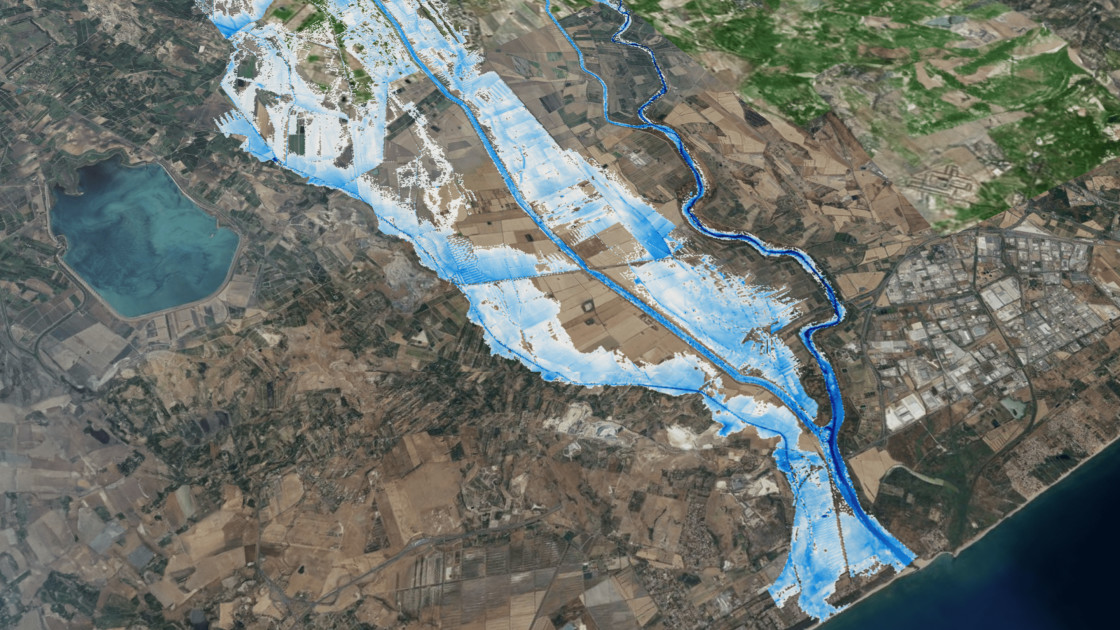
Initially, scientists modelled the Po River Valley, which contains vast landscapes and rugged terrain, including mountainous Alps and river systems. All of these natural areas have their own extremities: flooding, droughts, and snow – the latter being highly “difficult to simulate”.
Thereafter, scientists surveyed the Mediterranean which Brocca said: “is a good place to investigate extreme events both for too much and too little water.” The next round of surveys will explore Europe holistically, and Brocca plans to collaborate with industry to “allow the same principles to be applied around the world”.
Challenges To The Replica
While satellite data is highly reliable, it still possesses a few flaws. Those being, the need for ground observations and complex algorithms to decipher or validate the data, and delays to data transfers and access.
There is also the issue of imperfections affecting the model. To overcome such challenges, Brocca will employ the use of AI and machine learning to enhance granular data analysis and boost the pace of processing.
To conclude, Brocca remarked: “the collaborative efforts of scientists, space agencies, and decision-makers promise a future where Digital Twin Earths for hydrology provide invaluable insights for sustainable water management and disaster resilience.”


Thank you for your comment! It will be visible on the site after moderation.