ICEYE To Provide Disaster Data To Australia
19th Sep 2023
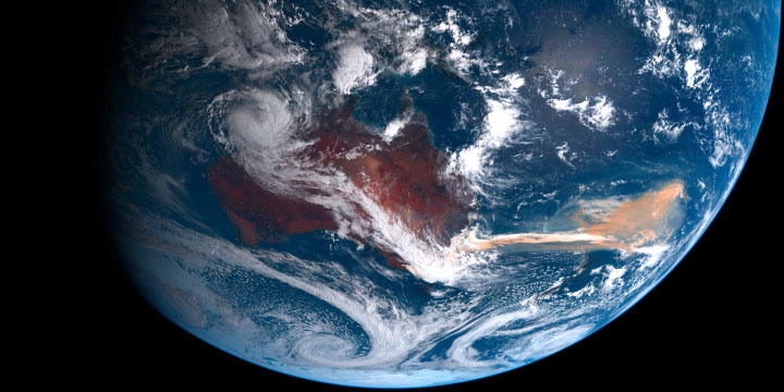
Finnish microsatellite company, ICEYE, has partnered with the Australian Federal Government to provide near real-time data captured during natural disasters. Expanding on a previous Flood Insights product agreement, the partnership will: “strengthen Australia’s capabilities to manage the impact of flood and bushfire events,” ICEYE said in a statement. Hazard data will be provided to all Australian states and territories.
Andy Read, Global Head of Government Solutions at ICEYE, said: “understanding the true impact of floods and bushfires quickly, can transform response and improve recovery outcomes for survivors. This partnership is about bringing that transformation to federal, state, and territory-level agencies across Australia.”
Providing Near Real-Time Data
ICEYE will provide near real-time data by leveraging their constellation of 25 Synthetic Aperture Radar (SAR) satellites. This will enable enhanced disaster response efforts through data and insights captured during floods and bushfires. ICEYE’s array of SAR satellites are able to view natural disasters day or night, and through cloud and smoke coverage in near-real time, making them “uniquely positioned to enhance emergency management decision-making”.
ICEYE’s SAR constellation lets the Finnish company directly contribute to mitigating Australia’s ongoing battles with natural disaster events. They added that the data will inform: “rapid disaster assessment and response, better resource allocation and improved coordination between national and local entities.”
SAR Satellites To Augment Australia’s Disaster Response
ICEYE’s Flood and Bushfire Insights product will combine SAR Earth observation imagery with ground data to “produce actionable intelligence”. The Flood Insights product – which Australia already utilises – will identify the extent that flood damage has affected infrastructure within 24-hours. Whereas, ICEYE’s Bushfire Insights product will promptly report property damage in near real-time. Both products will show emergency responders the “true impacts of the event,” which will help inform where to target recovery efforts in flood or fire affected communities.
Bolstering Australia’s Space Capabilities
The ICEYE partnership is a string in a long-line of efforts to bolster Australia’s space capabilities. Previous natural disaster events caused over A$5 billion of economic damage due to La Ninã or El Niño weather events. Consequently, remote areas where communication coverage is near non-existent are usually the most affected.
As such, Perth-Based Sat One inked a partnership agreement with OneWeb to access the British satellite company’s communication constellation that will target remote communities. Although this wasn’t the primary reason behind the partnership, the coverage will assist those affected by natural disasters in remote areas.


Thank you for your comment! It will be visible on the site after moderation.