60 Year History of Earth Observation Satellites & the Promise They Hold
15th Dec 2021
Some sources date the beginning of the remote sensing era and the following development of Earth observation satellites to the launch of the first artificial satellite, Sputnik-1, in 1957. However, this is not entirely true. Sputnik 1 was the simplest device that circled the Earth every 96 minutes and could only transmit radio signals back to Earth.
The first satellite explicitly designed for Earth observation, called Vanguard 2, was launched two years later, in 1959. It was supposed to take measurements of daytime cloudiness, but the data turned out to be unusable in the end.
Tiros 1 – officially the first satellite
In 1960, Vanguard-2 was replaced by the Tiros-1 satellite, which is exactly when the history of Earth remote sensing began.
However, to be completely accurate, the first images of the Earth were taken back in 1946 over the New Mexico desert with a camera attached to a German V-2 rocket. Still, the flight trajectory of the V-2 did not allow it to cross the Karman line (100 km), so it is wrong to call these shots space images.
So, let’s summarise. The first useful data on the Earth’s surface from space was obtained by the TIROS-1 spacecraft in 1960, which means that in 2020, Earth Observation technology turned 60 years old. We will tell you how the history of Remote Sensing has evolved during this time.
Optical earth observation satellites
Tiros was followed by the NOAA series of satellites of the National Oceanic and Atmospheric Administration, which used the Advanced Very High-Resolution Radiometer (AVHRR) that measures the ratio of reflection from the Earth in five spectral ranges, from visible to infrared. Although the tool was designed for meteorology, it has proven useful for both land and sea observations due to its multiple measurements on a global scale.
The Nimbus satellites, launched in 1964, were equipped with sensors capable of tracking ocean biological processes, atmospheric composition, and ice topography. They used visible light cameras, infrared and microwave radiometers, spectrometers, UV backscatter sensors, and coastal color scanners.
In 1972, NASA and the US National Academy of Sciences launched the first agricultural satellite, Landsat-1. Using spatial resolution, it showed large areas of the Earth’s surface in several regions of the electromagnetic spectrum, including the visible and near-infrared regions, which makes it possible to assess the Earth’s cover and its changes. The Landsat series has evolved and eventually acquired the ability to collect data in eight spectral bands with a spatial resolution of 30 meters.
SAR satellites
Beginning in the 1980s, SAR technology, synthetic aperture radars capable of taking measurements through cloud cover and without daylight, due to the delay between emission and reflection, has been actively developed, thereby establishing the location, altitude and scattering properties of the Earth’s surface. Examples of SAR satellites include the TerraSar-X, ICEYE, RadarSAT, and others.
LIDAR satellites
The most advanced remote sensing technology is LiDAR, which uses lasers for measurement. They are mainly used for topographic surveying and mapping of ice cover and for measuring the properties of the atmosphere and the Earth’s surface using fluorescence. Substances such as chlorophyll naturally fluoresce at specific wavelengths, making it possible to calculate the number of plants in a specific area, such as ocean algae blooms. Fluorescence is also useful when studying the atmosphere. For example, NASA’s Calipso satellite uses green and infrared LiDAR to obtain data on the height of clouds and even the properties of aerosols within them. It was Calypso that documented a large plume of sulfur dioxide invisible to other sensors.
Earth observation satellites today
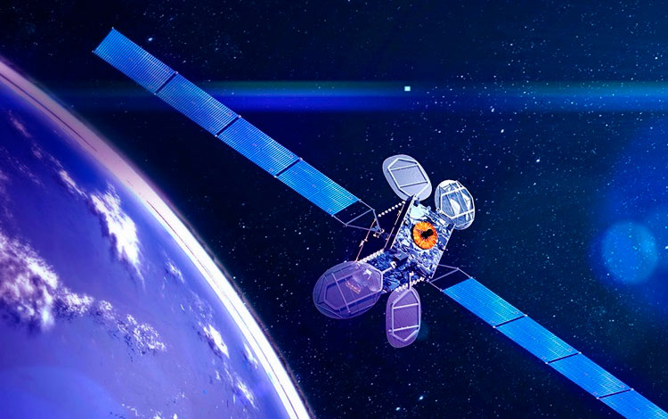
Over the 60 years of Earth observation, the number of satellites in orbits has grown to almost 1000, and experts predict that it will continue to grow by 8% annually. When it comes to the number of Earth observation satellites, North America (NASA), China, and Europe (European Space Agency) are in the lead. And this tendency is expected to continue.
The Earth observation market includes two main areas: exploration, production, and downstream — processing received information and its marketing. Simply put, one cannot exist without the other since the data obtained from Earth observation satellites, in its original form, is of little use to the general public. That is why the data processing tools are extremely important, along with satellite production and launching spacecraft into orbits. There are hundreds of companies providing downstream services. The most notable ones include Elecnor Deimos, Spire Global, Ecometrica, and others. Thanks to satellite data analytics tools developed by these companies, the government, military, business, environmental, scientific, and educational organizations can obtain the most accurate information about the state of the planet above and below the ground.
EOS analytics helps to:
- fight climate changes, alleviate the consequences of natural and man-made disasters;
- ensure border security, transport logistics at sea and on land;
- analyze the state of soils and water bodies, glaciers, flora, and fauna;
- monitor infrastructure facilities, underground utilities, mineral deposits, and much more.
The development of the EOS technology itself is also important. Modern sensors allow shooting with a spatial resolution of 25 cm per pixel and scan an area from several kilometers to several thousand in the capture band. Plus, most Earth observation satellites are CubeSats that do not exceed an average cardboard box in size, making them affordable for many customers who want to have their eyes in space.
The future of Earth Observation
The commercial value of EO products is growing rapidly across various industries. The United States, China, and Europe show evermore examples of how using the Earth observation technology positively affects their countries’ development. This gives promise to the future of Earth observation satellites and inspires hope that humanity, for its own safety, will finally reconsider its careless attitude towards the planet.





Thank you for your comment! It will be visible on the site after moderation.