Strange Jellyfish-shaped Cloud Appeared Over Africa: What Was That?
24th May 2024
In 2018, a weather satellite recorded a strange thunderstorm cloud resembling a jellyfish over western Africa. Scientists clarified that this unusual cloud formation was caused by a meteorological phenomenon that went wrong.
The strange jellyfish-shaped cloud was approximately 185 miles (300 kilometres) long. The Suomi NPP weather satellite, jointly operated by NASA and the National Oceanic and Atmospheric Administration (NOAA), detected it over central Mali. According to NASA’s Earth Observatory, the “bell” of this jellyfish-like cloud hovered above the city of Mopti, with its “tentacles” extending into Burkina Faso.
The Meteorological Phenomenon Behind The Cloud
The unusual cloud was created by a meteorological phenomenon called an outflow boundary. It is a shock wave of rapidly moving air emanating from thunderstorm clouds. According to NOAA, outflow boundaries, also known as gust fronts, occur when cold air from the clouds descends to the surface. This downward movement, known as a downdraft, causes the cold air to quickly spread outward like ripples in a pond, pushing the warmer air upward.
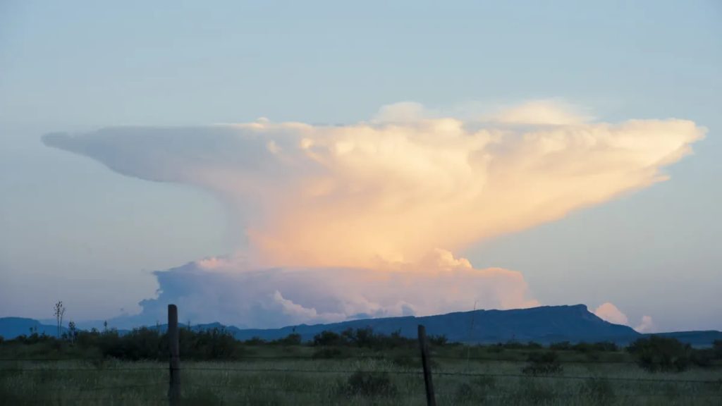
“The arc-shape line of clouds is caused by less dense air being lifted up and over the boundary,” explained Joseph Munchak, a meteorologist at NASA’s Goddard Space Flight Center, told Earth Observatory.
What Went Wrong With The Jellyfish-shaped Cloud?
Typically, the outflow boundary results in a large disk of elevated clouds, known as shelf or roll clouds, which often appear anvil-shaped when seen from the ground. But in this case, only a portion of the disk formed because the outflow boundary was partially disrupted by wind shear, added Munchak.
Dangerous Outflow Boundaries
In dry areas, outflow boundaries can stir up dust and sand from the surrounding landscape, forming temporary walls of particulates called haboobs, according to Earth Observatory. These dust storms, which typically last only a few minutes, often seem to appear suddenly after thunderstorms and can significantly reduce visibility and air quality, as noted by the National Weather Service.
Outflow boundaries, such as those resulting in a jellyfish-shaped cloud, can also pick up various objects, such as insects, seeds, and even birds. When this occurs, the debris wave can sometimes appear as dense rings in radar images captured by weather satellites.


Thank you for your comment! It will be visible on the site after moderation.