Copernicus: 25 Years of Environmental Insights
6th Jun 2023
From unveiling mind-blowing environmental insights to revolutionising our understanding of climate change, disaster response, and sustainable development, Copernicus has become the ultimate cosmic companion in our quest to protect and cherish our cosmic oasis. Can you believe it’s been 25 years since this revolutionary Earth observation program blasted off?
As we commemorate the remarkable quarter-century milestone of Copernicus, let’s delve into the extraordinary journey of this groundbreaking celestial eye.
Short History
The history of Copernicus traces its roots to Baveno, a small town in the northwest of Italy. There, on 19 May 1998, representatives from the European Commission, Europe’s space agencies, EUMETSAT and ESA signed the Baveno Manifesto. This pivotal document put forth a proposal for the creation of a monitoring program that would address global environmental and climate issues. Its overarching goal was to position Europe as a leader in tackling these challenges for the long term.
Fast forward to 2004, and the idea of a space-based observation component took shape, giving birth to the satellites we now know as the Copernicus constellation. The European Commission and ESA forged an agreement, paving the way for the development of the Sentinel family of satellites. These state-of-the-art technological marvels serve as the core of the EU’s Earth Observation system, playing a vital role in establishing Europe’s leadership in this field. ESA, working on behalf of the European Commission, took charge of their production, ensuring their successful launch and deployment.
In 2011, the name of Copernicus was chosen to replace GMES, as an homage to Polish astronomer Nicolaus Copernicus and his theory at the basis of heliocentric solar system model which “opened man to an infinite universe, previously limited by the rotation of the planets and the sun around the Earth and created an understanding of a world without borders”.
Why Is It So Important For Us?
Copernicus delivers 20 TB of geodata daily, equivalent to a 1.5-year-long film in high definition! For example, the full F.R.I.E.N.D.S series would only account for less than 2 minutes of Copernicus data production. The Copernicus programme is unique as it is the first EO initiative that provides data in such volumes and diversity.
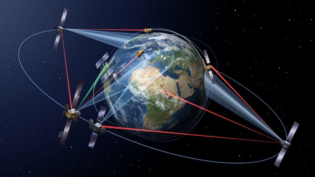
What kind of data? Copernicus information services are based on data from a constellation of six families of satellites, known as the “Sentinels”, and dozens of third-party satellites known as “contributing space missions”. These measuring devices in orbit sometimes operate alone and sometimes combined with sensors placed on the seas, land or in the air.
Copernicus stores the data and helps to provide a large amount of reliable and up-to-date information on the status of our planet. This data can be used to create different kinds of products, such as statistics and topographic maps. Copernicus contributes not only to European scientific and technical excellence, but is a part of a public service framework, allowing full, free, and open access to all the data collected. Anyone – scientists, policy makers, entrepreneurs, and ordinary citizens can use this data.
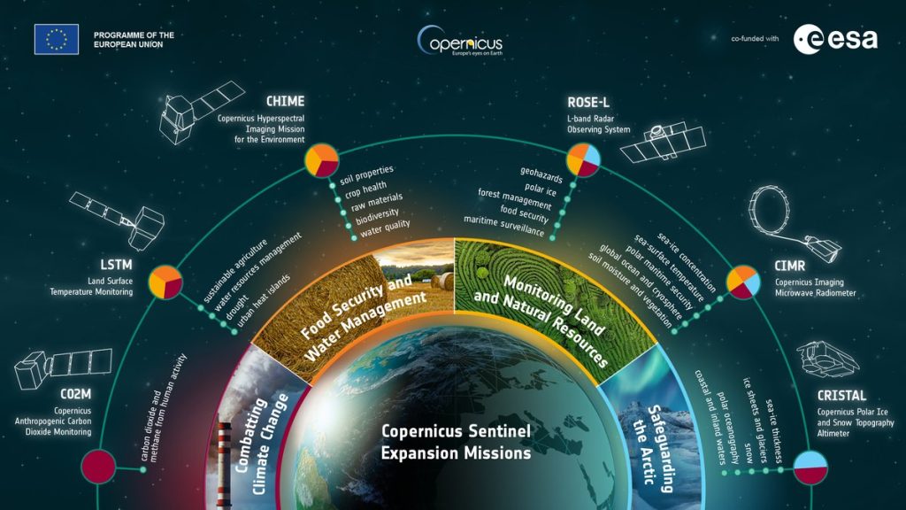
Services Provided by the Copernicus Programme
Its mission includes essential interrelated themes, incorporating six sets of services:
- atmosphere monitoring;
- marine environment monitoring;
- land monitoring;
- climate change;
- emergency management;
- security.
With regards to the environment, Copernicus detects the presence of aerosols that destroy the ozone layer, analysing atmospheric composition and biodiversity. It evaluates the melting of the polar ice cap in the Arctic, determines the quality of air and water, monitors ocean levels, coastal areas, and forests to help limit the damage from the threat of earthquakes, floods, and fires to ensure our safety.
Serving the marine world, Copernicus tracks marine pollution affecting aquatic ecosystems and the fishing industry as part of a development cooperation policy. On land, it warns of early signs of deforestation and desertification, oversees the irrigation of fields and monitors crops for better food management. Further to these examples, Copernicus can serve the tourism industry, urban development, archaeology, oil and gas, and the insurance sector.
3 Facts You Never Knew About Copernicus
- While the Sentinel satellites rightfully steal the spotlight in the Copernicus program, there’s more to this cosmic extravaganza than meets the eye. Copernicus embraces the use of in situ sensors, including ground-based, sea-borne, and air-borne monitoring systems, to complement the wealth of data provided by the Sentinels.
- What is common between Sentinel-1 and bowling? The first satellite launched by Copernicus was Sentinel-1A, on 3 April 2014. In order to sustain its operations for the planned minimum 7-year mission, Sentinel-1 is powered through two solar arrays. These two arrays are the same length as a bowling lane – 20 metres. Continuing with the bowling metaphor, Sentinel-1 weighs as much as 317 bowling balls!
- Satellites such as Sentinel-2 and -3 carry so-called multispectral “cameras” that see things that are sometimes invisible to the human eye, such as algal blooms, the health of vegetation, soil moisture, etc.
Moreover, Sentinel satellites can help detect hidden cultural heritage sites. Deviations in crop and grass growth patterns or soil marks detected via Earth Observation data can hint at about buried archaeological artifacts.
On 8 June, Copernicus celebrates its 25th anniversary! Well, as per the vision of the 1998 founders, Copernicus is keeping a watchful eye over our planet.


Thank you for your comment! It will be visible on the site after moderation.